
Trustindex verifies that the original source of the review is Google. Amazing works have used this company for 3 years, always delivers above expectations.Trustindex verifies that the original source of the review is Google. Fantastic work , very quick fast turn around , drawings are easy to understand , overall i'm very pleased and would highly recommend this serviceTrustindex verifies that the original source of the review is Google. Absolutely delighted with their service! Arrived thr next day and had the survey done after the weekend! We will definitely be using them again.Trustindex verifies that the original source of the review is Google. We recently hired Borna Surveys for measured building surveys on a couple of our properties, and we couldn’t be more pleased with the service. They promptly scheduled our survey for the very next day and arrived with a state-of-the-art laser scanner. The level of detail in the survey was truly impressive—far exceeding our expectations. Not only were they thorough and professional, but their pricing was also very reasonable, and they delivered results within the promised timeframe. We are extremely satisfied with Borna Surveys and will definitely use their services again in the future. Highly recommended!Trustindex verifies that the original source of the review is Google. AwesomeTrustindex verifies that the original source of the review is Google. We used Borna's setting out engineer to set out a new build house. Prompt, friendly and professional service from start to finish. Would highly recommend Thanks Karman! Colin Smith Project ManagerTrustindex verifies that the original source of the review is Google. We have hired john for some issues regarding boundery wall , really happey with his services and prompt response . Great work done overall thanks Muhammad YasirTrustindex verifies that the original source of the review is Google. Kamran came to set out on our site he was very professional and accurate. We were very happy with his service and will be using Kamran on other site in the future.
Get the most out of BIM & CAD methodology
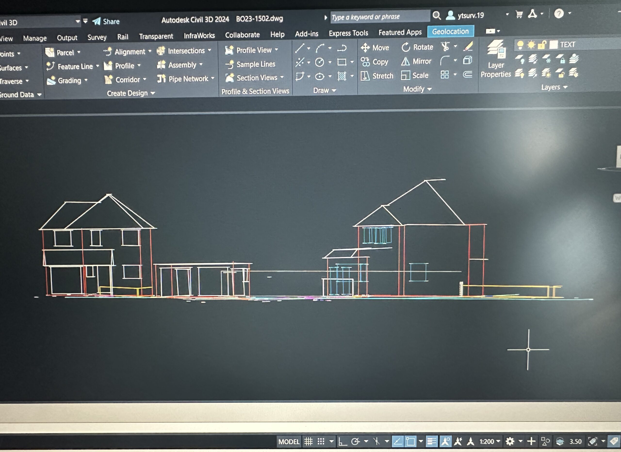
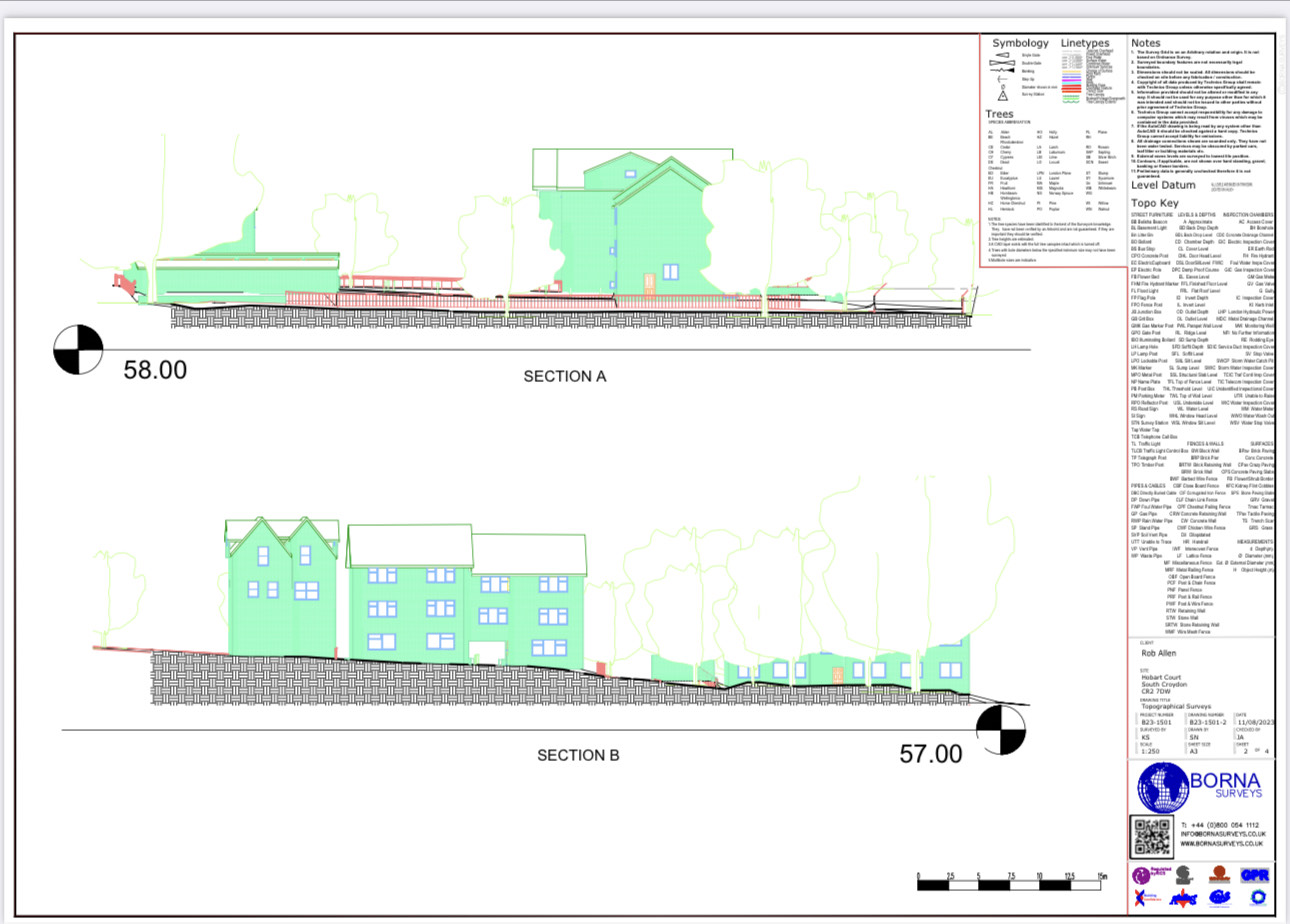
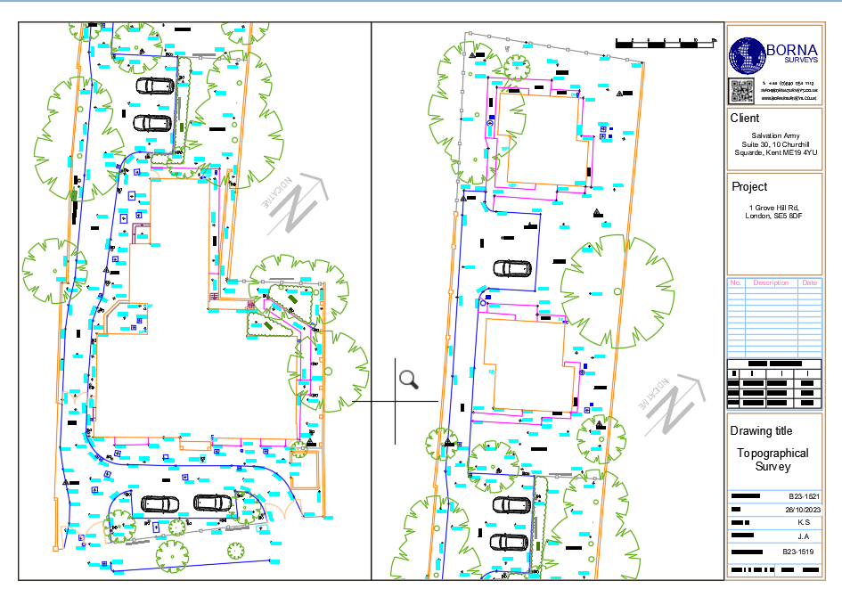
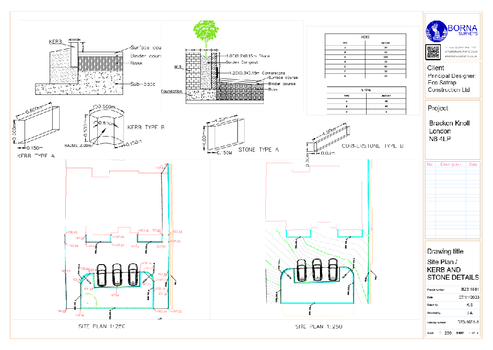
Our CAD Technology Department plays a major role within Borna Surveys carrying out pure CAD projects and supporting all our survey departments. Borna Surveys utilise our in-house CAD teams allowing us to ensure that all work is carried out to the highest standards of quality, while also keeping prices competitive. We have undertaken various Scan to BIM projects and our track record includes a full laser scan to REVIT model of Battersea Power station. The National Institute of Building Sciences (NIBS) provides valuable resources on the implementation and standards of BIM in construction, available on their website: NIBS BIM Standards.
Our wide range of consultancy services can be used to incorporate BIM into your business, bringing with it new processes and growth opportunities:
Business Consultancy
Project Consultancy
Common Data Environment
Project Implementation
Visualisation
Content and Templates
As an early adopter of BIM we are well placed to play our part in collaborative projects. Whether creating as-built models from surveyed data or simply creating parametric models of individual components for use in BIM related software. We have an understanding and positive solution based approach to this growing industry.
Our deliverables include:
AutoCAD – Revit – 3Ds Max MicroStation – Architecture Cyclone – Cloudworx – LisCAD Blender – Pointools Solid Works, PhotoShop, Aveva LFM, Key TerraFIRMA, etc.
Our deliverables include:
AutoCAD – Revit – 3Ds Max MicroStation – Architecture Cyclone – Cloudworx – LisCAD Blender – Pointools Solid Works, PhotoShop, Aveva LFM, Key TerraFIRMA, etc.
FAQ
CAD (Computer-Aided Design) is a 2D and 3D drafting tool, while BIM (Building Information Modeling) is a more advanced process that includes 3D modeling with detailed information about building components. Borna Surveys utilizes CAD for precise drafting and BIM for comprehensive project visualization, coordination, and data management, ensuring accuracy and efficiency.
Borna Surveys employs CAD for detailed design and drafting, allowing for accurate representation of project elements. Our CAD services facilitate the creation of plans, elevations, and sections, providing a solid foundation for project visualization and documentation.
Yes. Borna Surveys offers seamless transitioning services from CAD to BIM, ensuring that your project benefits from the enhanced visualization, coordination, and information management capabilities of Building Information Modeling. Our team ensures a smooth integration process, optimizing project workflows.
BIM enhances collaboration by providing a centralized platform for all project stakeholders to access and update project information. Borna Surveys utilizes BIM to streamline communication, resolve design conflicts, and facilitate coordinated decision-making, ultimately improving project efficiency and reducing errors.
CAD and BIM services are applicable across various industries, including architecture, engineering, construction, and facility management. Borna Surveys customizes its CAD and BIM services to meet the unique requirements of clients in these sectors, ensuring optimal project outcomes and efficient information management throughout the project lifecycle.
Why Choose Borna Surveys? We Guarantee
Accuracy and Precision:
We prioritise accuracy in every aspect of our work, ensuring that our clients receive reliable survey data for informed decision-making.
Timely Delivery:
Our efficient processes and advanced technology enable us to deliver survey results promptly, meeting your project timelines and deadlines.
Customised Solutions:
Recognising that each project is unique, we tailor our services to meet your specific requirements, providing personalised solutions that add value to your endeavors.
Experienced Professionals:
Our team of seasoned surveyors brings years of industry experience to the table, guaranteeing a high level of expertise in every project we undertake.
Client-Centric Approach:
We prioritize clear communication and collaboration, working closely with our clients to understand their needs and deliver results that exceed expectations.
Our Services


Get in Touch
phone
+44 800 054 1112
Business Hours
- Every day 9am – 8pm