
Posted onTrustindex verifies that the original source of the review is Google. Company did some great work for my wife and I after we were unhappy with other surveyors. Worth the price Thank you.Posted onTrustindex verifies that the original source of the review is Google. Great work, just completed boundary dispute and measure building survey. The team is very professional and diligent. I recommend this companyPosted onTrustindex verifies that the original source of the review is Google. I had a great experience working with Borna Surveys. They carried out a measured building survey for me, including detailed plans, sections, and elevations, and the quality of their work was excellent. The team were professional, responsive, and very easy to work with throughout the process. The survey was delivered on time and to a very high standard, which made a real difference to my project. I would highly recommend Borna Surveys to anyone looking for reliable and accurate surveying services.Posted onTrustindex verifies that the original source of the review is Google. I recently used Borna Surveys for a measured building survey, and I am extremely pleased with the service provided. Kamran was professional, reliable, and very easy to communicate with throughout the process. The survey was carried out efficiently, and the final drawings and report were detailed, accurate, and delivered on time. The quality of work and attention to detail were excellent, and the price was very reasonable. I would not hesitate to recommend Borna Surveys to anyone needing a measured building survey or related services.Posted onTrustindex verifies that the original source of the review is Google. Kamran, at Borna surveyors, was very professional, polite , clear and concise. I received a very detailed report within days at a very reasonable price compared to others. I fully recommend using this company especially for a boundary survey.Posted onTrustindex verifies that the original source of the review is Google. Fantastic Survey and Services, have used this company time and time and have proven themselves every time. Highly recommend.Posted onTrustindex verifies that the original source of the review is Google. Used for setting out survey for foundations and come back again for brickwork setting the pins. Fantastic service and on timePosted onTrustindex verifies that the original source of the review is Google. ⭐️⭐️⭐️⭐️⭐️ So professional wow! Job done so smoothly and efficiently. Thank you 🙏🏽Posted onTrustindex verifies that the original source of the review is Google. Amazing works have used this company for 3 years, always delivers above expectations.Posted onTrustindex verifies that the original source of the review is Google. Kamran was quick to respond and did the survey as requested
Our drone surveys offer accurate aerial data for mapping, inspection, and surveying, making them ideal for a variety of industries.
DRONE SURVEYS & INSPECTIONS
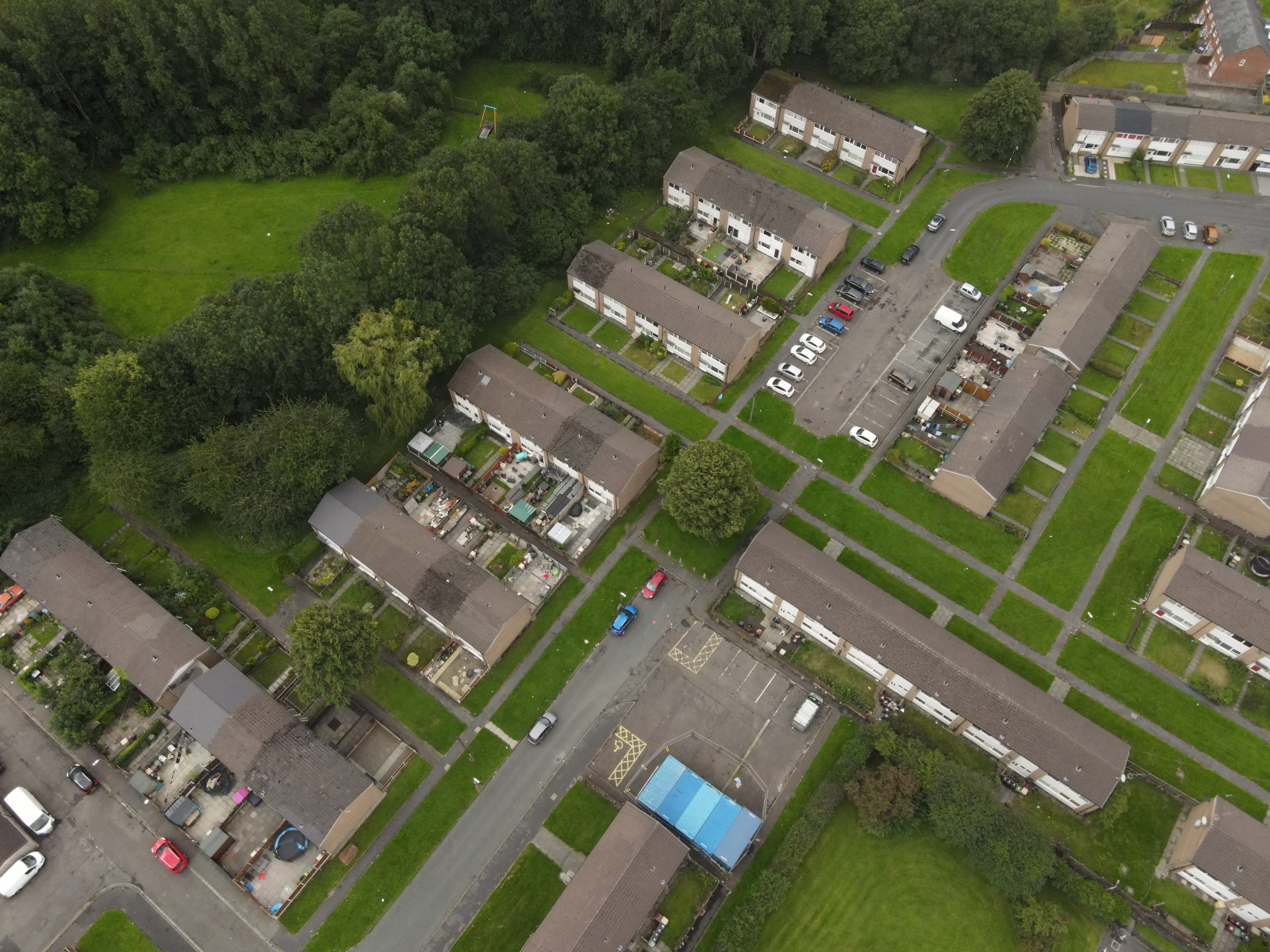
Our drone surveys provide high-resolution aerial data for construction, mapping, and inspection projects, offering unparalleled accuracy and efficiency.
Using drones is the safer and more cost effective solution when it comes to providing accurate information on any project that involves working at height, hard to reach areas or a quick turnaround of 3D data capture.
According to Industry Standards on Drone Surveys, this technology enhances both data accuracy and operational efficiency.
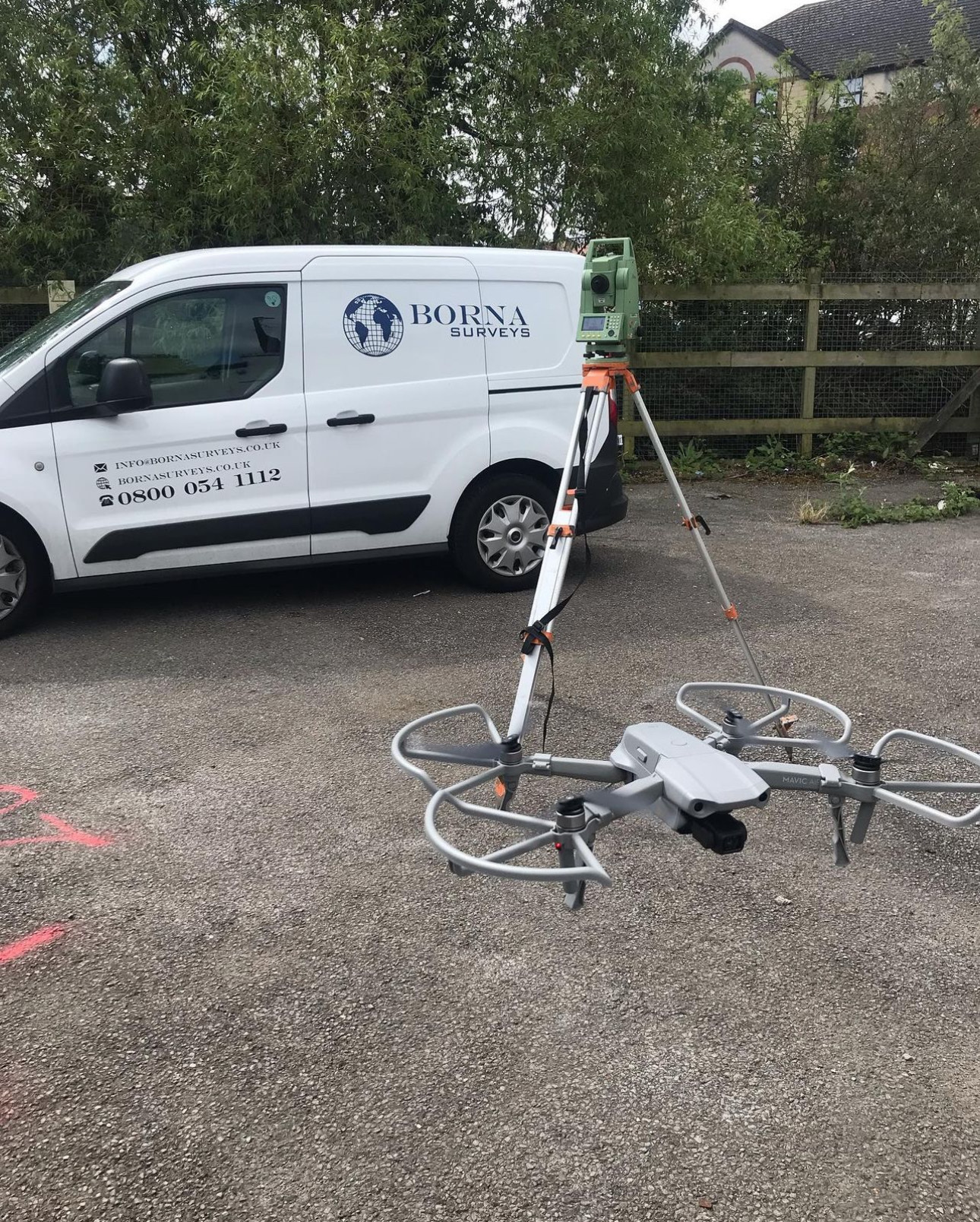
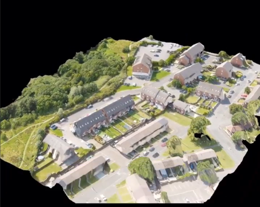
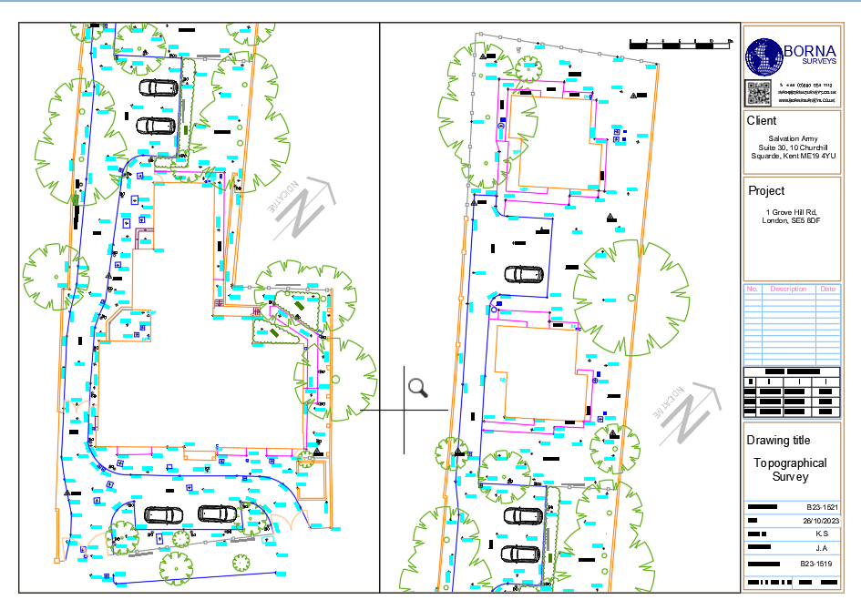
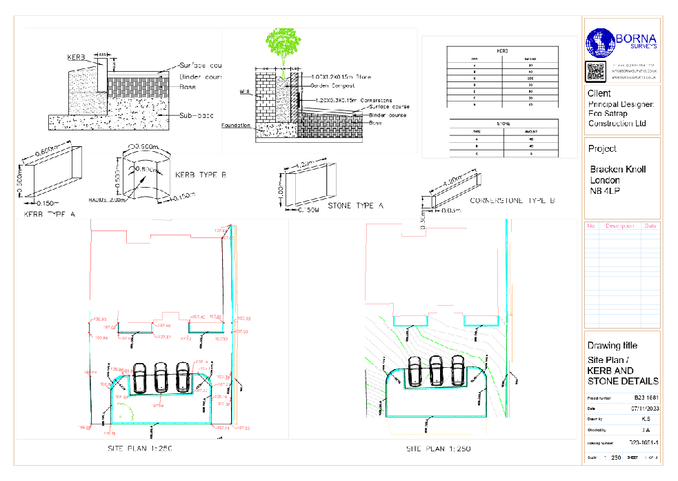
An aerial mapping allows the capture of Imagery & 3D Data. From video roof reports to combining 3D Drone Survey data with 3D Laser Scanner data, Borna Surveys carries out a variety of work involving the use of Drones.
The benefits of a drone survey include:
Efficiency:
Rapid data collection over large areas.
Accuracy:
High-resolution imagery for precise measurements.
Safety:
Avoids risks associated with manual surveys in challenging terrain.
Cost-effectiveness:
Reduces time and resource requirements.
Versatility:
Applicable to various industries like agriculture, construction, and environmental monitoring.
Real-time Data:
Enables quick decision-making with up-to-date information.
Accessibility:
Access hard-to-reach or hazardous locations without physical presence.
Environmental Impact:
Minimizes ecological disruption compared to traditional survey methods.
Detailed Visualization:
Provides 3D models and maps for comprehensive analysis.
Documentation:
Creates a comprehensive record for future reference and analysis.
A Drone Survey allows the capture of Imagery & 3D Data. From video roof reports to combining 3D Drone Survey data with 3D Laser Scanner data, Borna Surveys carries out a variety of work involving the use of Drones.
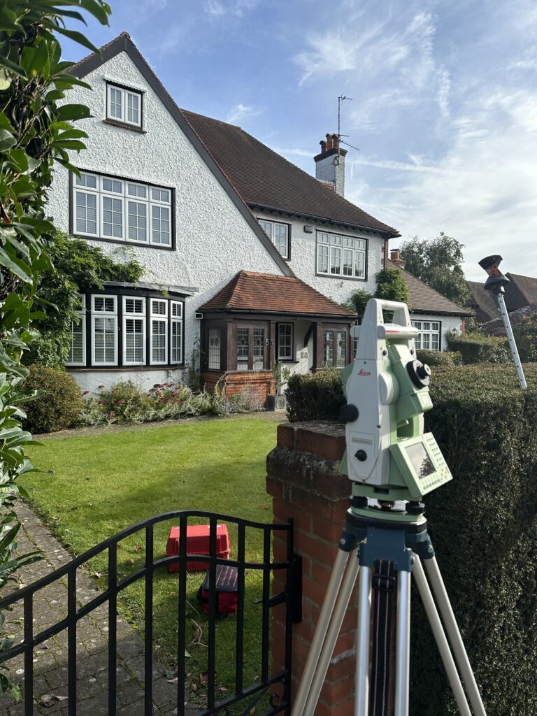
A Drone Survey can also be used in combination with traditional land surveying techniques. Our surveyors will pick up all survey detail with total stations & GPS keeping a very high surveying accuracy, and then can capture larger areas of spot levels with the drone survey. This allows a highly accurate survey but reduces time considerably on larger sites.
FAQ
A Drone Survey involves using unmanned aerial vehicles equipped with advanced sensors to capture high-resolution images and data of a site. Borna Surveys utilises drone technology to provide cost-effective, efficient, and accurate surveys, offering a comprehensive overview of your project site.
Drone Surveys offer several advantages over traditional methods, including rapid data collection, accessibility to hard-to-reach areas, and the ability to generate detailed 3D models. Borna Surveys leverages drone technology to enhance efficiency, accuracy, and data visualization for a wide range of projects.
Drone Surveys are versatile and applicable to various industries such as construction, agriculture, mining, and environmental monitoring. Borna Surveys tailors its drone services to meet the specific needs of clients in these sectors, providing valuable insights for planning, monitoring, and decision-making.
Absolutely. Drone technology excels in capturing data for projects of all sizes. Borna Surveys utilises state-of-the-art drones with advanced sensors to efficiently cover large areas, providing clients with detailed and timely information crucial for effective project management.
Borna Surveys delivers a range of actionable outputs, including high-resolution imagery, 3D models, topographic maps, and volumetric analysis. These deliverables empower clients with comprehensive data for decision-making, project planning, and monitoring, showcasing the versatility and value of our Drone Survey services.
Why Choose Borna Surveys? We Guarantee
Accuracy and Precision:
We prioritise accuracy in every aspect of our work, ensuring that our clients receive reliable survey data for informed decision-making.
Timely Delivery:
Our efficient processes and advanced technology enable us to deliver survey results promptly, meeting your project timelines and deadlines.
Customised Solutions:
Recognising that each project is unique, we tailor our services to meet your specific requirements, providing personalised solutions that add value to your endeavors.
Experienced Professionals:
Our team of seasoned surveyors brings years of industry experience to the table, guaranteeing a high level of expertise in every project we undertake.
Client-Centric Approach:
We prioritize clear communication and collaboration, working closely with our clients to understand their needs and deliver results that exceed expectations.
Our Services


Get in Touch
phone
+44 800 054 1112
Business Hours
- Every day 9am – 8pm