THE LATEST
PROJECTS

GET A QUOTE NOW

Topographical survey by Bornasurveys.co.uk

TOPOGRAPHICAL SURVEY
PROJECT NO: B23-1521

Borna Surveys Specialist in Road Design

TOPOGRAPHICAL SURVEY
PROJECT NO: B23-1681

Topographical survey specialists covering comprehensive services across the entire UK for accurate and reliable results.

TOPOGRAPHICAL SURVEY
PROJECT NO: B23-1709

Borna Surveys excels in laser scanning, delivering accurate and efficient services tailored to your needs with precision and expertise.

3D LASER SCANNING
PROJECT NO: B23-1507

FAQ

A topographical survey meticulously maps both natural and artificial features of a land area, including contours, elevations, vegetation, and structures. This comprehensive data is crucial for informed design and planning processes in various fields such as architecture, engineering, and environmental management. For further information click Here.

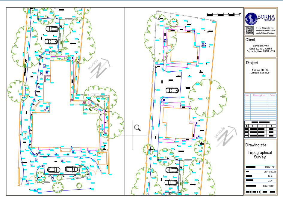
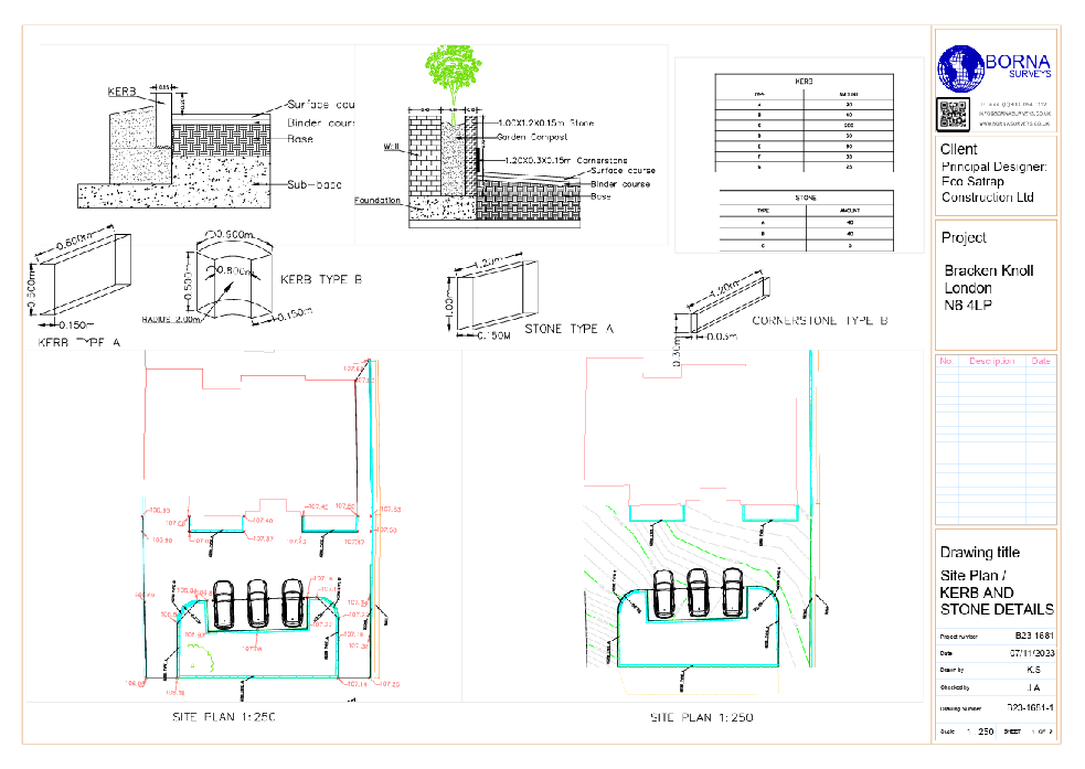
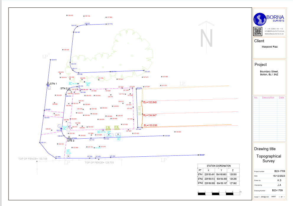
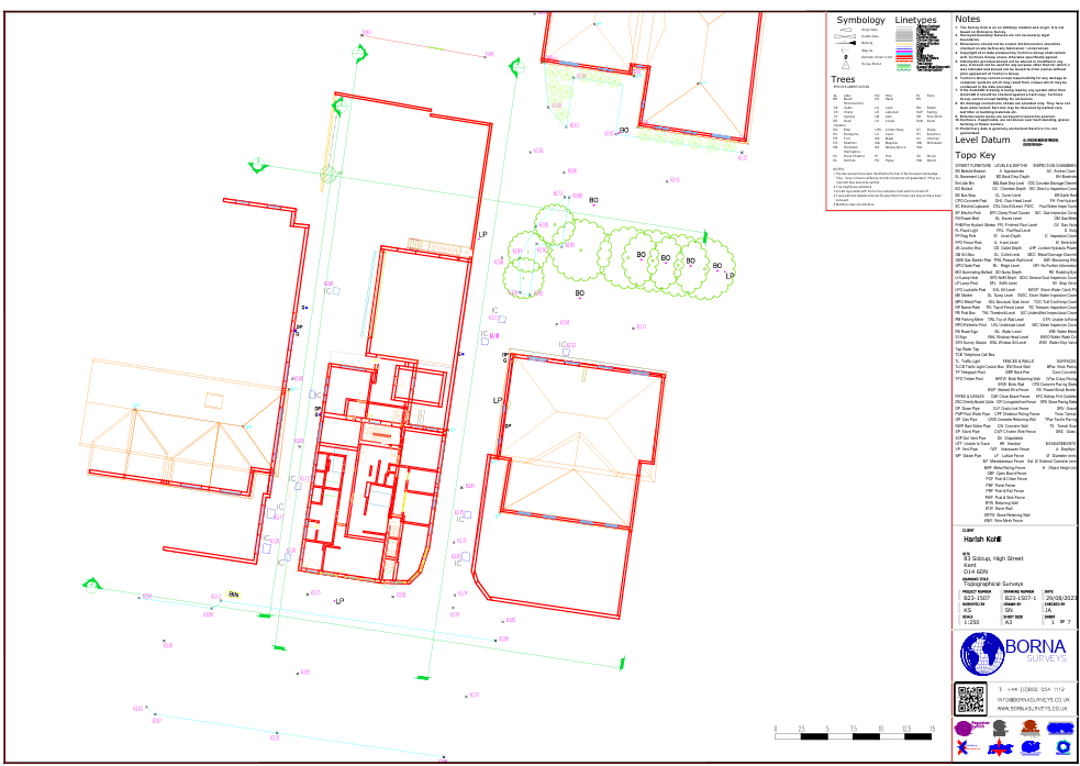
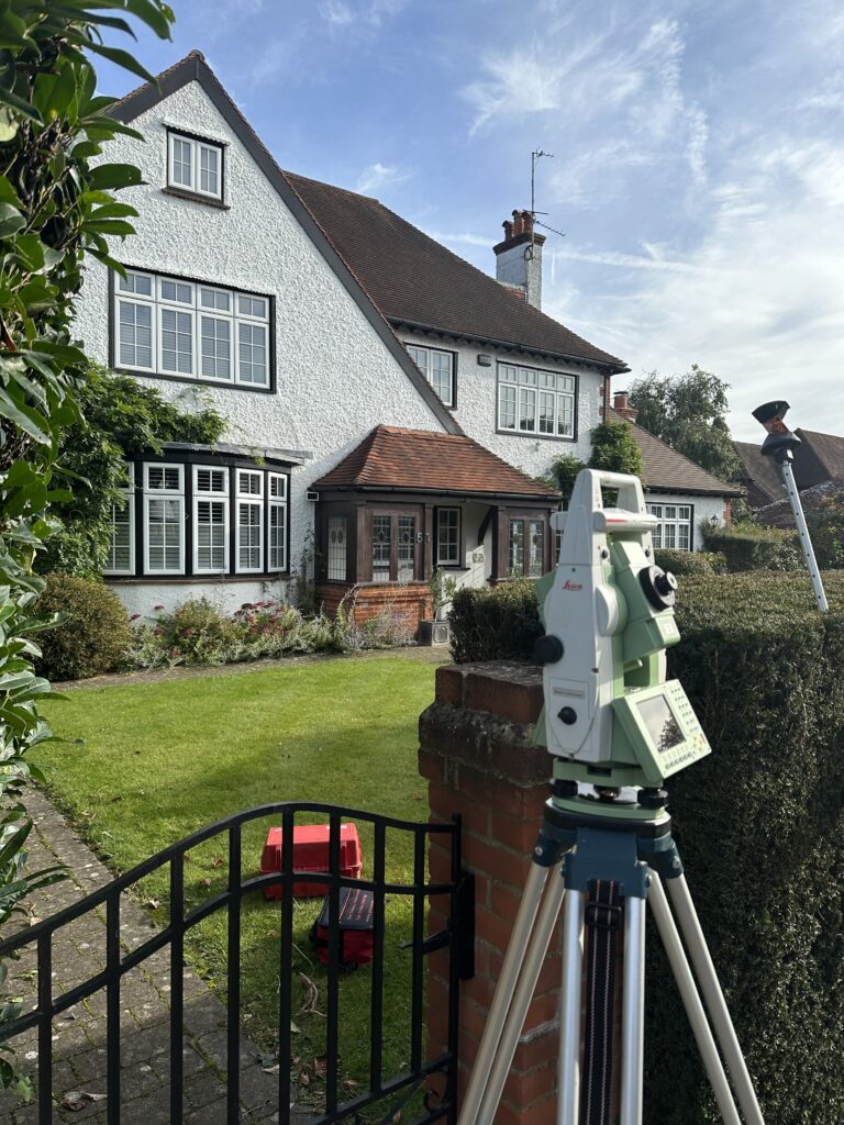
A laser scanning service employs laser technology to capture precise and detailed three-dimensional measurements of objects, environments, or structures, facilitating accurate data acquisition for purposes such as surveying, modeling, or documentation. For further information click Here.

Our measured survey services can be booked within 48 hours of contacting us. For properties up to 7 rooms, please note that we typically require one full day to ensure a thorough and precise survey.

Measured survey costs vary based on property size, complexity, and location. For an exact price, individuals can request a quote tailored to their specific project needs. Contact us to receive a personalized estimate for your measured survey requirements. For get a quick quote click Here.

A boundary dispute involves disagreements or conflicts between individuals, entities, or nations regarding the demarcation of physical or legal limits, often related to property, territory, or jurisdictional boundaries. For get a quick quote click Here.


We provide measured survey services throughout the UK, covering various locations to meet your property documentation needs accurately and efficiently.

BOUNDARY DISPUTE

Why Choose Borna Surveys? We Guarantee

Accuracy and Precision:

We prioritise accuracy in every aspect of our work, ensuring that our clients receive reliable survey data for informed decision-making.

Timely Delivery:

Our efficient processes and advanced technology enable us to deliver survey results promptly, meeting your project timelines and deadlines.

Customised Solutions:

Recognising that each project is unique, we tailor our services to meet your specific requirements, providing personalised solutions that add value to your endeavors.

Experienced Professionals:

Our team of seasoned surveyors brings years of industry experience to the table, guaranteeing a high level of expertise in every project we undertake.

Client-Centric Approach:

We prioritize clear communication and collaboration, working closely with our clients to understand their needs and deliver results that exceed expectations.

Our Services

Measured Building
Survey

Floor Plan, Sections, Elevations, 3D Modeling, Topographical Survey

TOPOGRAPHICAL
SURVEYS

Land Surveys. Verified Views. Right to Light Surveys

3D Laser Scanning

point cloud, Revit, Section and Elevations

SITE ENGINEERING SURVEYS

Setting Out. Grid Lines. Datums.

HYDROGRAPHY
SURVEYS

Flood Mitigation. Channel Profiles. Long & Cross sections.

Boundary Dispute

Solve the Dispute, Setout The Boundary Line

DRONE SURVEYS

Aerial Inspection. 3D Point Clouds. Volumes. Time Lapse.

ROAD DESIGN

Civil 3D Autocad. Design Alignments.

SUBDIVISION SURVEYS

Measure Vacant Land. Subdivide Land.

Settingout Engineer

Setting out, Grid Line, Datums, As-built

CAD & BIM
SURVEYS

AutoCAD, Revit, SketchUp

UNDERGROUND UTILITY

PAS128. GPR. Drainage & CCTV.

VOLUMETRIC SURVEYS

Calculate Cut & Fill. Estimate Volume . Long & Cross section.

Fencing

Fences, Rails, Gates, Sheds

Get in Touch

phone


+44 800 054 1112

Email

Business Hours

Send Us a Message