
Posted onTrustindex verifies that the original source of the review is Google. Company did some great work for my wife and I after we were unhappy with other surveyors. Worth the price Thank you.Posted onTrustindex verifies that the original source of the review is Google. Great work, just completed boundary dispute and measure building survey. The team is very professional and diligent. I recommend this companyPosted onTrustindex verifies that the original source of the review is Google. I had a great experience working with Borna Surveys. They carried out a measured building survey for me, including detailed plans, sections, and elevations, and the quality of their work was excellent. The team were professional, responsive, and very easy to work with throughout the process. The survey was delivered on time and to a very high standard, which made a real difference to my project. I would highly recommend Borna Surveys to anyone looking for reliable and accurate surveying services.Posted onTrustindex verifies that the original source of the review is Google. I recently used Borna Surveys for a measured building survey, and I am extremely pleased with the service provided. Kamran was professional, reliable, and very easy to communicate with throughout the process. The survey was carried out efficiently, and the final drawings and report were detailed, accurate, and delivered on time. The quality of work and attention to detail were excellent, and the price was very reasonable. I would not hesitate to recommend Borna Surveys to anyone needing a measured building survey or related services.Posted onTrustindex verifies that the original source of the review is Google. Kamran, at Borna surveyors, was very professional, polite , clear and concise. I received a very detailed report within days at a very reasonable price compared to others. I fully recommend using this company especially for a boundary survey.Posted onTrustindex verifies that the original source of the review is Google. Fantastic Survey and Services, have used this company time and time and have proven themselves every time. Highly recommend.Posted onTrustindex verifies that the original source of the review is Google. Used for setting out survey for foundations and come back again for brickwork setting the pins. Fantastic service and on timePosted onTrustindex verifies that the original source of the review is Google. ⭐️⭐️⭐️⭐️⭐️ So professional wow! Job done so smoothly and efficiently. Thank you 🙏🏽Posted onTrustindex verifies that the original source of the review is Google. Amazing works have used this company for 3 years, always delivers above expectations.Posted onTrustindex verifies that the original source of the review is Google. Kamran was quick to respond and did the survey as requested
Why Underground Utility Surveys Are Essential
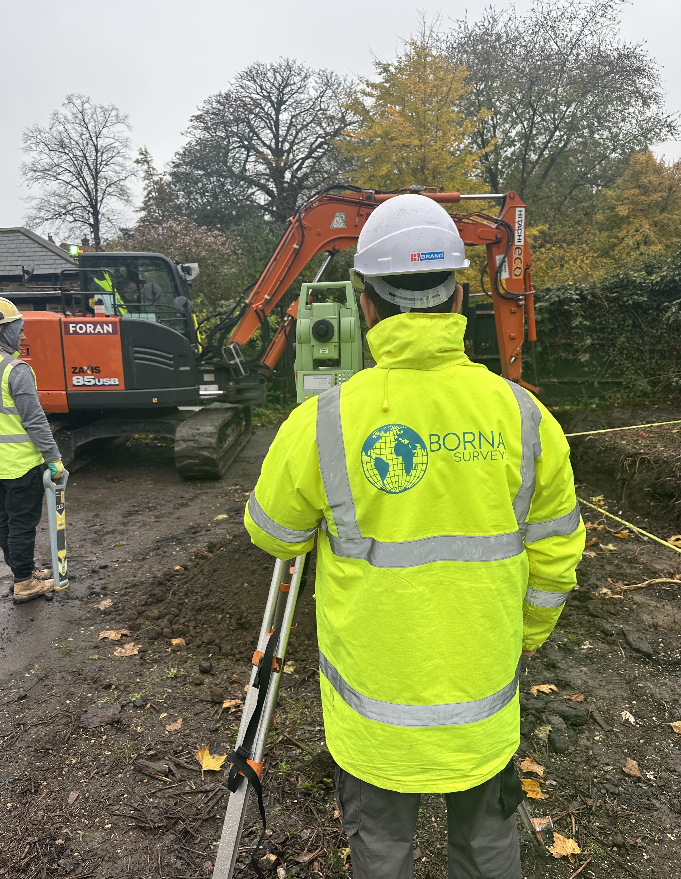
Underground utility surveys are crucial for construction and excavation projects, ensuring accurate mapping of buried infrastructure and preventing costly damages. Without proper surveys, projects risk damaging underground pipes, cables, and drainage systems, leading to expensive repairs and project delays.
To ensure safety and efficiency, our underground utility surveys use advanced scanning technologies to detect and map underground structures before any excavation begins.
How Underground Utility Surveys Work
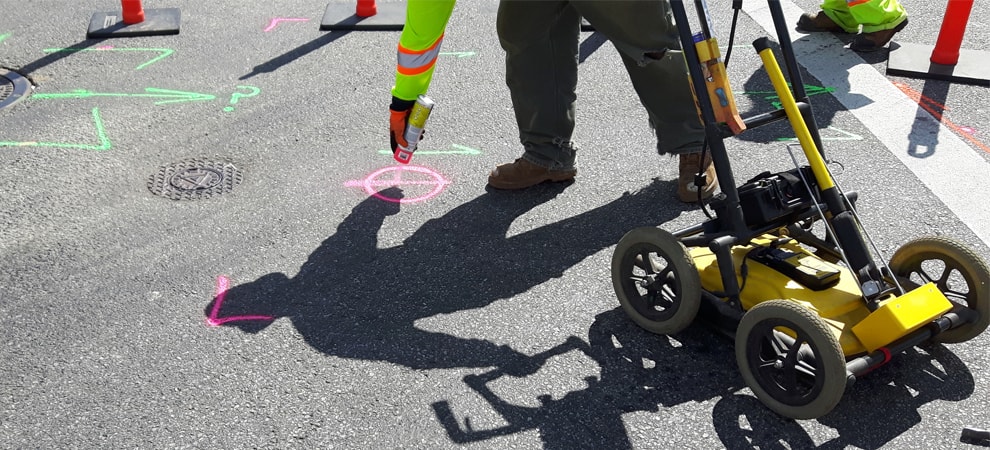
Our underground utility surveys use cutting-edge techniques such as Ground Penetrating Radar (GPR) and Electromagnetic Location (EML) to precisely identify underground utilities. These methods help:
Detect buried pipes, cables, and other infrastructure
Minimize risks during excavation
Improve project planning and efficiency
We offer a wide range of services including:
- Underground utility mapping
- PAS128 surveys
- CCTV drainage condition Surveys
- Drainage connectivity surveys
- GPR void detection
- Borehole clearance
- Desktop utility searches
Our Advanced Utility Mapping Techniques
We employ a range of utility mapping techniques to ensure accurate results:
1. Ground Penetrating Radar (GPR)
This method allows us to detect non-metallic and metallic objects beneath the surface, making it essential for comprehensive underground utility surveys.
2. Electromagnetic Location (EML)
EML technology is used to trace metallic cables and pipes, offering a reliable mapping solution for engineers and construction teams.
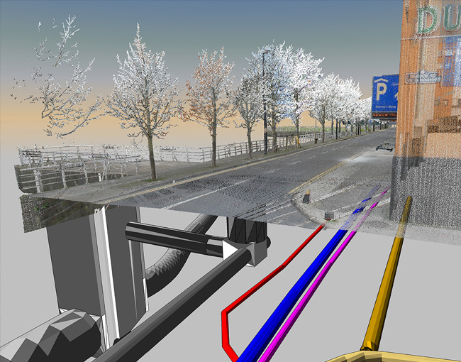
3. GPS & GIS Mapping
Once the underground utilities are located, we integrate the data into Geographic Information Systems (GIS) for precise mapping and future reference.
Why Choose Our Underground Utility Surveys?
Compliance with UK Regulations:
We adhere to the latest industry standards and guidelines.
Advanced Technology:
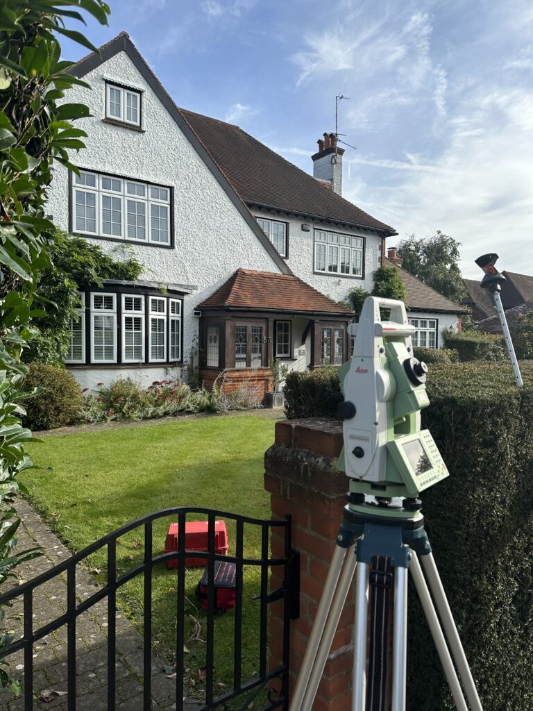
Our surveys use the latest equipment to provide accurate results.
Experienced Surveyors:
Our team has years of expertise in conducting underground utility surveys for various projects.
Pipe and cable depths, locations and routes are very important to record from a health and safety, time, and money point of view. We have staff who have undertaken Sygma utility training in the various detection equipment available including Ground Penetration Radar. Borna Surveys will to the best of our ability identify and locate buried utilities but depending on the nature of the site the percentage of all buried utilities detected will vary.
FAQ
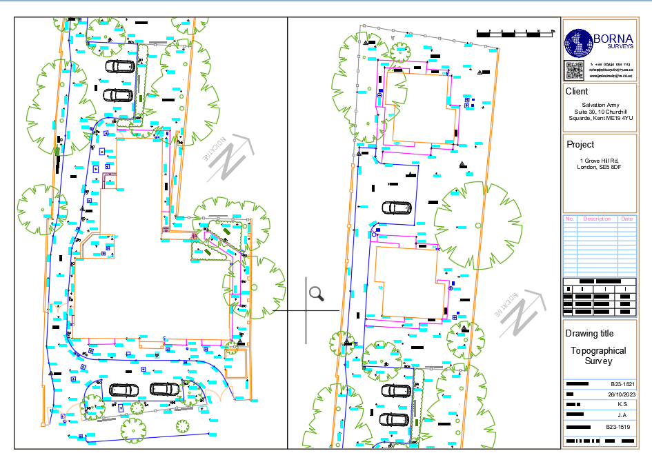
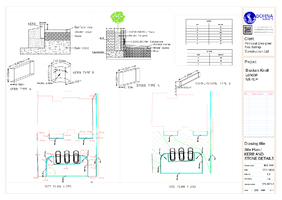
An Underground Utility Survey involves mapping and locating subsurface utilities to prevent damage during construction. Borna Surveys conducts thorough surveys using advanced technology, ensuring the safety of excavation activities and preventing disruptions to existing utility infrastructure.
Borna Surveys employs a combination of ground-penetrating radar (GPR), electromagnetic locators, and other advanced techniques to locate and map underground utilities. Our surveys provide accurate data on the depth, type, and location of utilities, enabling safe excavation and construction.
Absolutely. Borna Surveys specializes in utility mapping for both new construction and existing facilities. Our surveys provide detailed information on the layout of underground utilities, supporting effective facility management, maintenance, and infrastructure planning.
Borna Surveys’ Underground Utility Survey minimizes the risk of accidental utility damage during construction, avoiding costly repairs and project delays. By accurately mapping subsurface utilities, our surveys contribute to overall project efficiency, safety, and cost-effectiveness.
Yes. Underground Utility Survey is essential for projects of all sizes. Even in small-scale construction, unexpected utility damage can lead to significant disruptions and costs. Borna Surveys tailors its services to meet the specific needs of clients, ensuring the safety and success of projects, regardless of size.
Why Choose Borna Surveys?
We Guarantee
Accuracy and Precision:
We prioritise accuracy in every aspect of our work, ensuring that our clients receive reliable survey data for informed decision-making.
Timely Delivery:
Our efficient processes and advanced technology enable us to deliver survey results promptly, meeting your project timelines and deadlines.
Customized Solutions:
Recognizing that each project is unique, we tailor our services to meet your specific requirements, providing personalized solutions that add value to your endeavors.
Experienced Professionals:
Our team of seasoned surveyors brings years of industry experience to the table, guaranteeing a high level of expertise in every project we undertake.
Client-Centric Approach:
We prioritize clear communication and collaboration, working closely with our clients to understand their needs and deliver results that exceed expectations.
Our Services


Get in Touch
phone
+44 800 054 1112
Business Hours
- Every day 9am – 8pm