
Trustindex verifies that the original source of the review is Google. Amazing works have used this company for 3 years, always delivers above expectations.Trustindex verifies that the original source of the review is Google. Fantastic work , very quick fast turn around , drawings are easy to understand , overall i'm very pleased and would highly recommend this serviceTrustindex verifies that the original source of the review is Google. Absolutely delighted with their service! Arrived thr next day and had the survey done after the weekend! We will definitely be using them again.Trustindex verifies that the original source of the review is Google. We recently hired Borna Surveys for measured building surveys on a couple of our properties, and we couldn’t be more pleased with the service. They promptly scheduled our survey for the very next day and arrived with a state-of-the-art laser scanner. The level of detail in the survey was truly impressive—far exceeding our expectations. Not only were they thorough and professional, but their pricing was also very reasonable, and they delivered results within the promised timeframe. We are extremely satisfied with Borna Surveys and will definitely use their services again in the future. Highly recommended!Trustindex verifies that the original source of the review is Google. AwesomeTrustindex verifies that the original source of the review is Google. We used Borna's setting out engineer to set out a new build house. Prompt, friendly and professional service from start to finish. Would highly recommend Thanks Karman! Colin Smith Project ManagerTrustindex verifies that the original source of the review is Google. We have hired john for some issues regarding boundery wall , really happey with his services and prompt response . Great work done overall thanks Muhammad YasirTrustindex verifies that the original source of the review is Google. Kamran came to set out on our site he was very professional and accurate. We were very happy with his service and will be using Kamran on other site in the future.
Welcome to Borna Surveys, where precision meets innovation. Our Volumetric Survey services are tailored to meet the diverse needs of industries ranging from construction and mining to environmental management.
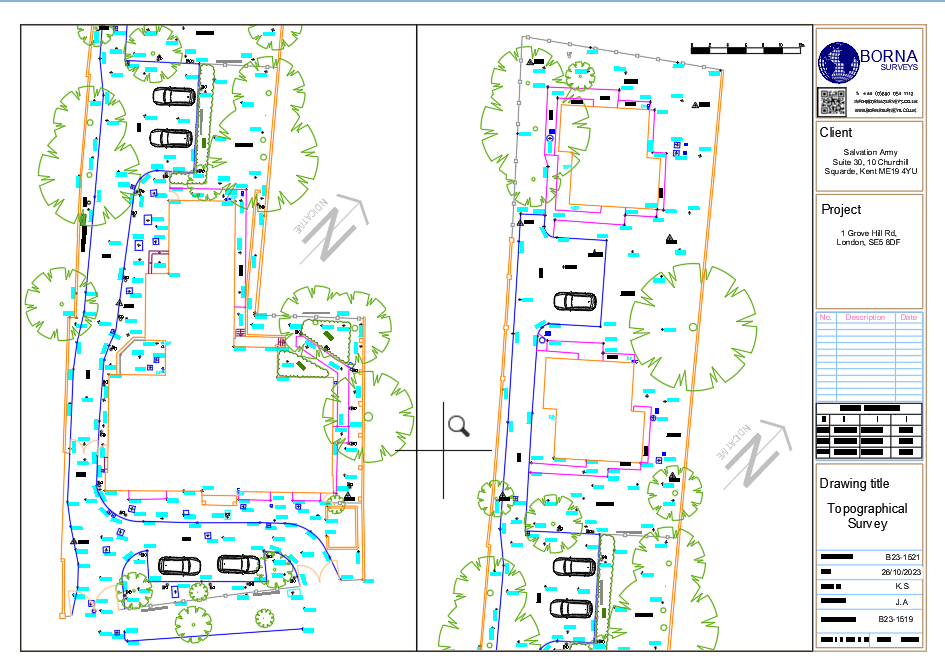
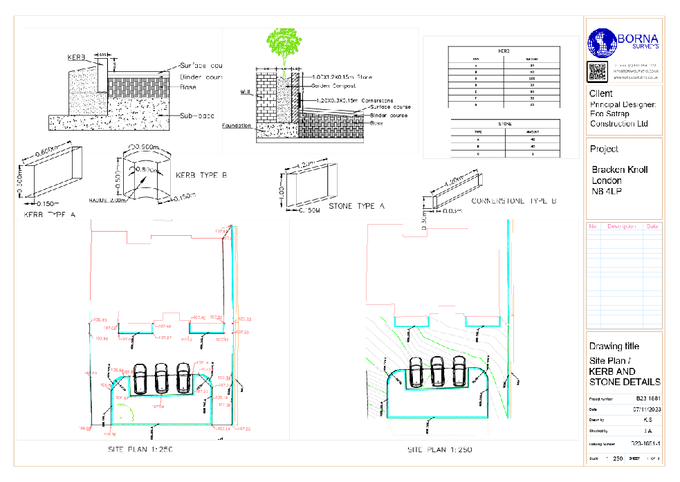
Volumetric Surveys: Precision in Measurement, Insight in Data
Understanding and quantifying volume changes in terrain, stockpiles, or excavations is essential for project planning, management, and compliance. Borna Surveys employs cutting-edge technology and a meticulous approach to deliver accurate and actionable volumetric survey data.
What We Offer:
Accurate Volume Calculations:
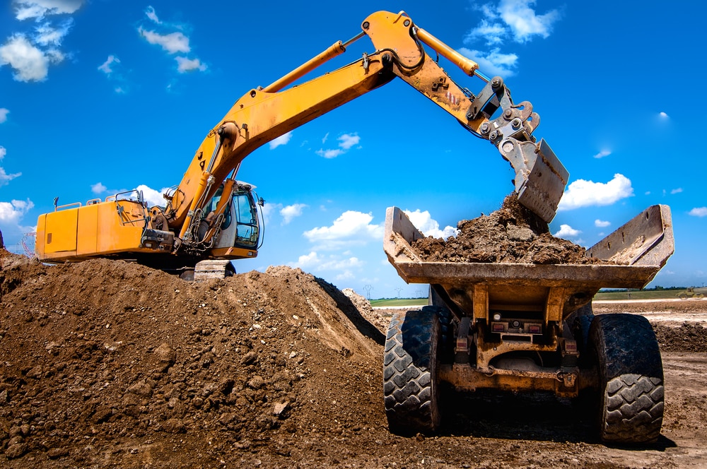
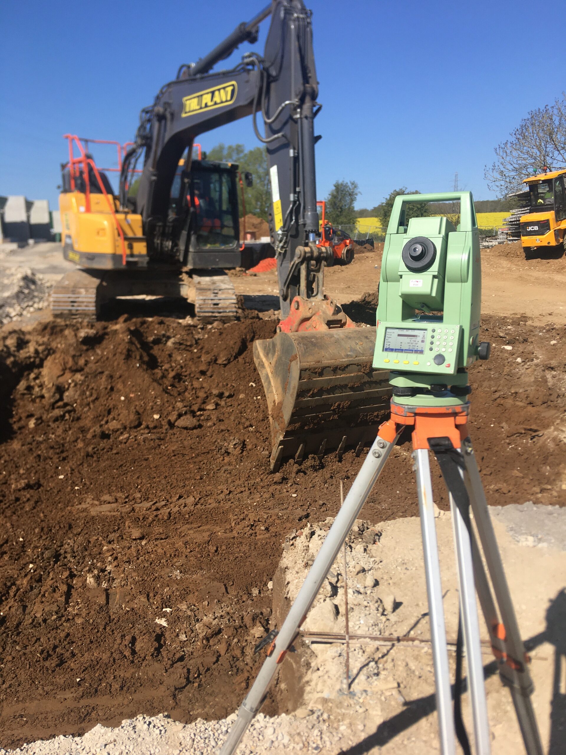
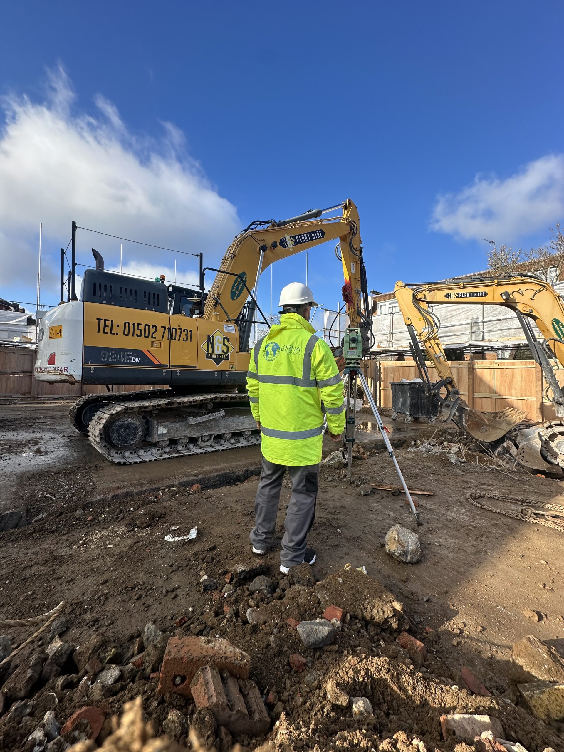
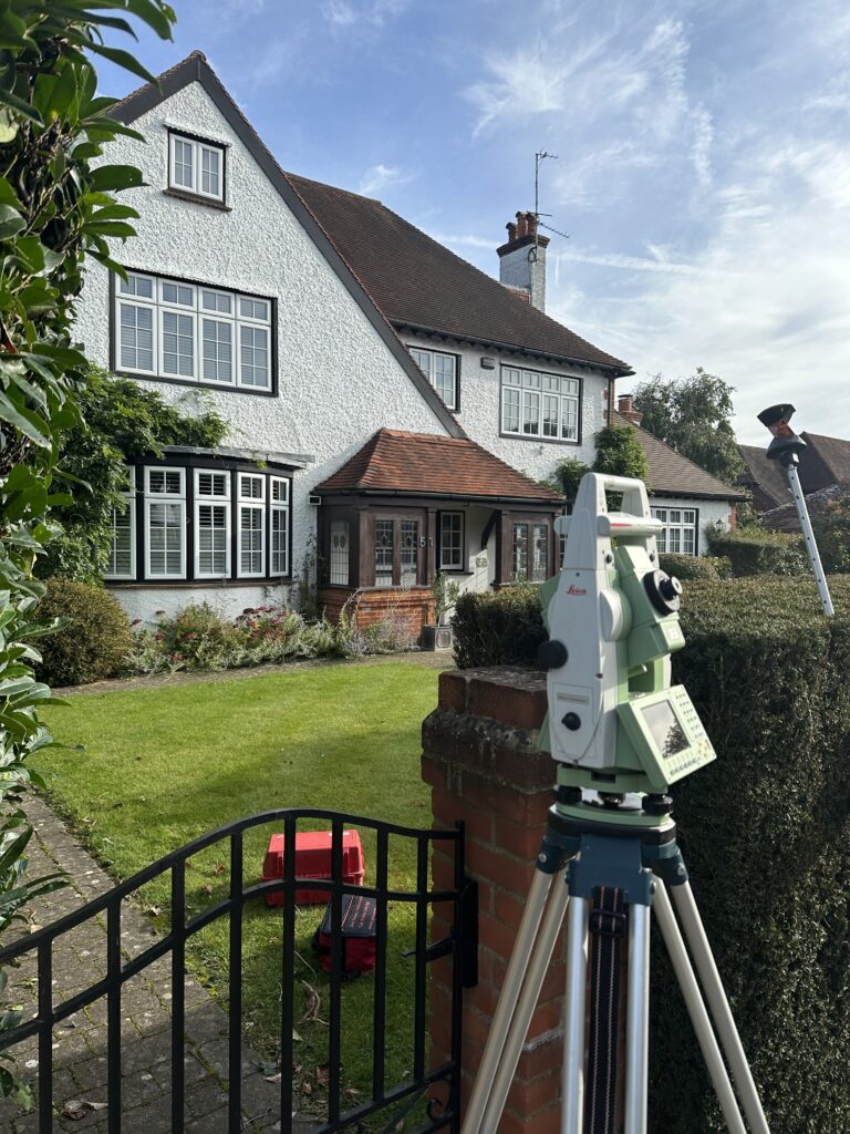
Borna Surveys utilizes advanced surveying instruments, such as drones and 3D laser scanners, to capture precise measurements of surfaces. This enables us to provide highly accurate volume calculations for stockpiles, earthworks, and other volumetric entities.
Efficient Monitoring:
Our Volumetric Surveys are instrumental in monitoring changes over time. Whether you're tracking stockpile levels, monitoring excavation progress, or assessing environmental changes, our surveys provide the data needed for informed decision-making.
Cost-Effective Solutions:
By employing state-of-the-art technology, Borna Surveys ensures that volumetric surveys are conducted efficiently, saving both time and costs for our clients. Our streamlined processes and accurate data contribute to optimized project management.
Customized Reporting:
We understand that each project is unique. Borna Surveys delivers customized volumetric survey reports that align with your specific requirements. Our detailed reports provide insights into volume changes, helping you make informed decisions for your project.
Compliance Assurance:
Our Volumetric Surveys adhere to industry standards and regulations, ensuring that your project remains in compliance with environmental and safety guidelines. Borna Surveys is committed to delivering survey data that stands up to scrutiny and supports regulatory requirements.
Why Choose Borna Surveys for Volumetric Surveys?
At Borna Surveys, we combine expertise, technology, and a client-focused approach to deliver Volumetric Survey services that exceed expectations. Our commitment to precision, efficiency, and actionable insights makes us a trusted partner for projects across various industries.
Discover the difference that accurate volumetric data can make for your project. Contact Borna Surveys today to discuss your specific needs and let us tailor a Volumetric Survey solution that aligns with your goals.
We also carry out stockpile surveys in quarries and depots for auditing purposes.
Landfill surveys are carried out for our clients to establish volumes of fill and remaining void. We also carry out engineering surveying work for capping and restoration. Closed landfills are surveyed on an annual basis to monitor settlement.
We can now also survey dangerous areas with state of the art drone technology, which not only reduces the risks involved with surveying a site but in some cases is even more accurate because drone-generated point clouds gather millions of points compared to the hundreds gathered in a ground-based survey.
FAQ
A Volumetric Survey involves precise measurement and calculation of volumes for entities such as stockpiles, excavations, and terrain. This service is crucial for project planning, monitoring changes over time, and optimizing resource management. Borna Surveys utilises advanced technology to deliver accurate volumetric data.
Borna Surveys employs cutting-edge surveying instruments, including drones and 3D laser scanners, to capture precise measurements of surfaces. This technology allows us to calculate volumes with a high level of accuracy, providing valuable data for various applications.
Absolutely. Volumetric Surveys by Borna Surveys are ideal for monitoring changes in stockpile levels, earthworks, and environmental features over time. Our surveys provide insights into volume variations, supporting informed decision-making and project management.
Borna Surveys utilizes efficient surveying processes and advanced technology to ensure cost-effective Volumetric Survey solutions. By streamlining our workflows and leveraging accurate data, we contribute to optimized project management, saving both time and costs for our clients.
Yes, Borna Surveys delivers customized volumetric survey reports tailored to your project’s specific needs. Our detailed reports provide clear insights into volume calculations, helping you make informed decisions and communicate project data effectively to stakeholders.
Why Choose Borna Surveys? We Guarantee
Accuracy and Precision:
We prioritise accuracy in every aspect of our work, ensuring that our clients receive reliable survey data for informed decision-making.
Timely Delivery:
Our efficient processes and advanced technology enable us to deliver survey results promptly, meeting your project timelines and deadlines.
Customised Solutions:
Recognising that each project is unique, we tailor our services to meet your specific requirements, providing personalised solutions that add value to your endeavors.
Experienced Professionals:
Our team of seasoned surveyors brings years of industry experience to the table, guaranteeing a high level of expertise in every project we undertake.
Client-Centric Approach:
We prioritize clear communication and collaboration, working closely with our clients to understand their needs and deliver results that exceed expectations.
Our Services


Get in Touch
Phone
+44 800 054 1112
Business Hours
- Every day 9am – 8pm