
Posted on GoogleTrustindex verifies that the original source of the review is Google. Used for setting late notice and still came and got the job done will definitely be using again and passing to there number on to other clientsPosted on GoogleTrustindex verifies that the original source of the review is Google. I've had a great experience using Borna Surveys. The surveys are straightforward, easy to complete, and cover a variety of interesting topics. The platform is user-friendly, and I appreciate the clear communication throughout the process. Rewards are delivered as promised, making participation feel worthwhile. Overall, Borna Surveys is a reliable survey platform that offers a simple and enjoyable way to share opinions and earn rewards.Posted on GoogleTrustindex verifies that the original source of the review is Google. I’ve used Borna Surveys multiple times and have recommended them to family and friends. Their service is always professional, reliable, and great value for money. The team are brilliant to deal with, and I wouldn’t hesitate to use them again in the future.Posted on GoogleTrustindex verifies that the original source of the review is Google. Kamran at Borna Surveys was great to deal with—very efficient, quick to respond, and turned around both the quote and drawings promptly. Easy communication throughout. Would highly recommend.Posted on GoogleTrustindex verifies that the original source of the review is Google. I recently used Borja Surveys and was extremely pleased with the service provided. Karan was professional,reliable and very easy to communicate with throughout the process. Quality of work were excellent and very reasonable price. Would recommend Borna SurveysPosted on GoogleTrustindex verifies that the original source of the review is Google. We used Borna Survey for a measured building and boundary survey for our property. The job professionally completed. Highly recommended.Posted on GoogleTrustindex verifies that the original source of the review is Google. Really good support - prompt on picking up the enquiry and very quick to undertake the survey and report - we needed their help to verify the height of our building for BSA 2022 purposes and the service was very good - thoroughly recommendPosted on GoogleTrustindex verifies that the original source of the review is Google. Great experiance and really professionalPosted on GoogleTrustindex verifies that the original source of the review is Google. Company did some great work for my wife and I after we were unhappy with other surveyors. Worth the price Thank you.Posted on GoogleTrustindex verifies that the original source of the review is Google. Great work, just completed boundary dispute and measure building survey. The team is very professional and diligent. I recommend this company
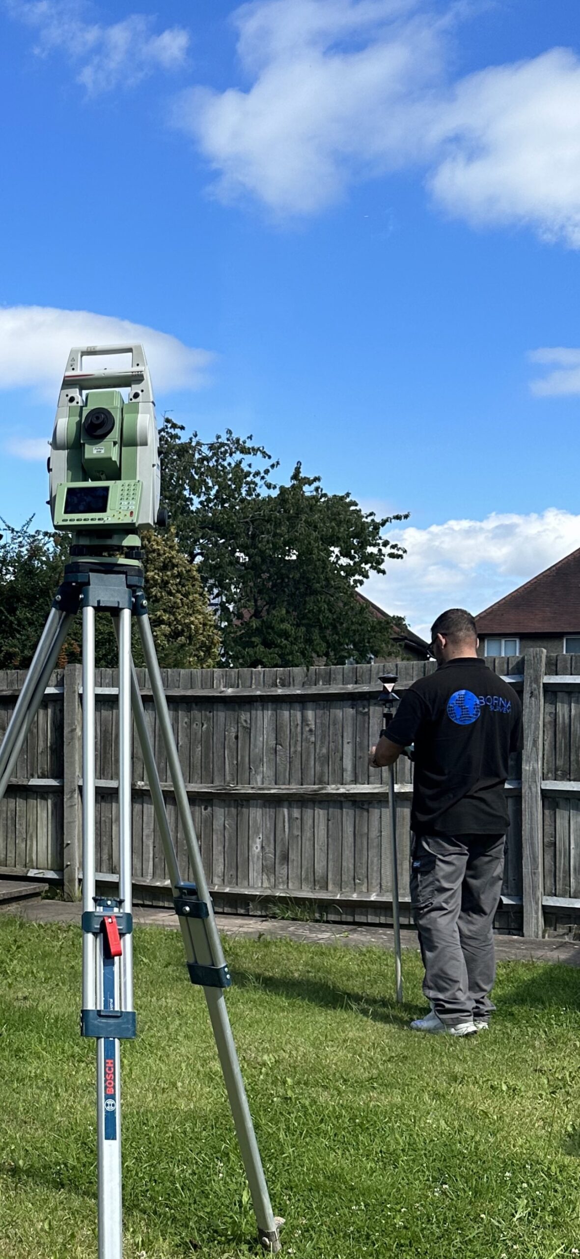
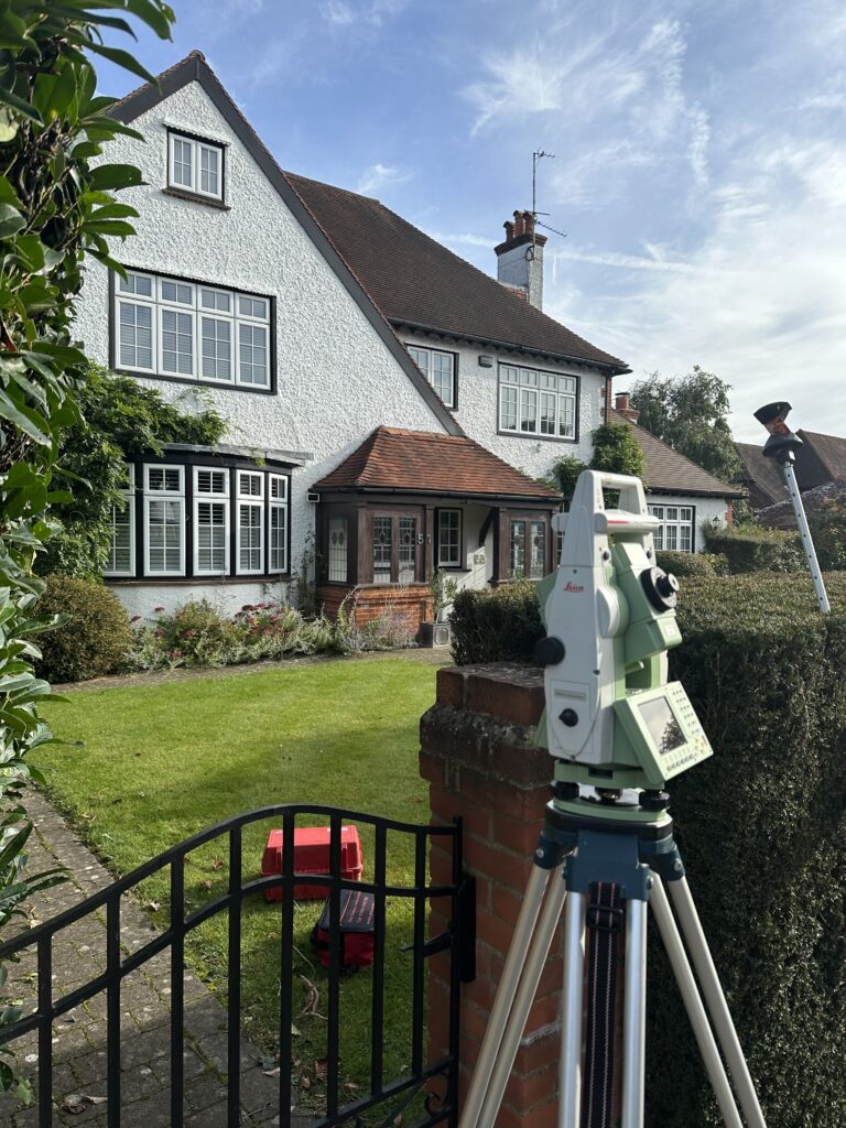
Topographical Survey services provide detailed land mapping. However, they do not typically include subsurface features. At Borna Surveys, our expert team utilises advanced technology to deliver precise data on elevations, contours, vegetation, and structures, offering a comprehensive view of your terrain.
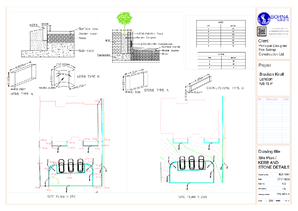
Topographical surveys are vital for construction projects, offering detailed insights into the land’s features. Consequently, architects and engineers can design structures that harmonize with the existing landscape.
What is a topographical survey?
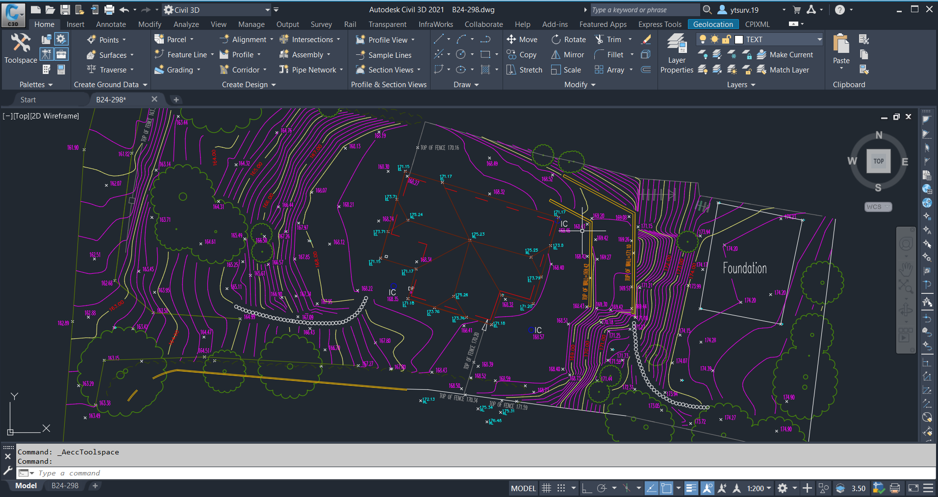
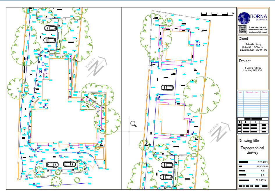
A topographical survey is a detailed mapping of the natural and man-made features of a piece of land. In addition, an accurate topographical survey captures the elevation, contours, vegetation, structures, and other essential elements, presenting a holistic view of the terrain. Certainly our team of skilled surveyors utilises state-of-the-art technology, including GPS and advanced mapping tools, to ensure accuracy and reliability in every survey. In conclusion, accurate topographical data is essential for urban planning. Therefore, investing in precise surveys can prevent costly project delays.
WHAT IS TOPOGRAPHICAL SURVEY USED FOR?
Urban Planning:
Our Topographical Survey data informs city planners by providing accurate terrain details, essential for sustainable urban development.
Construction Projects:
Accurate topographic data assists architects and engineers in designing structures that harmonize with existing landscapes.
Infrastructure Development:
Aiding in the planning and design of roads, bridges, utilities, and other infrastructure projects.
Land Development:
Assessing the suitability of land for development and determining the impact on the surrounding environment.
Environmental Studies:
Conducting a topographical survey supports environmental impact assessments by mapping ecosystems and natural features.
Mining and Quarrying:
Assisting in site planning, resource extraction, and environmental impact assessments in the mining industry.
3D Modeling:
Serving as a foundation for creating accurate three-dimensional models of the terrain for various applications.
Precision in Action: Advanced Technology Driving Topographical Surveys for Urban Planning and Construction
Our topographical survey process is distinguished by precision and cutting-edge technology. Furthermore, we employ state-of-the-art equipment and methodologies, meticulously capturing detailed data on terrain, structures, and vegetation. consequently, this meticulous approach ensures accuracy across various applications, such as urban planning, construction, and environmental assessments.
Key Components of a Topographical Survey:
Contour Lines:
Contour lines depict the elevation changes across the land, providing valuable information about slopes and gradients. This data is crucial for architects, engineers, and developers to design structures that seamlessly integrate with the natural topography.
Natural Features:
From water bodies to vegetation and geological formations, a topographical survey captures the existing natural features of the land. Understanding these elements helps in making informed decisions about land use and environmental considerations.
Man-Made Structures:
Buildings, roads, bridges, and other structures are meticulously mapped during a topographical survey. This information is essential for assessing the impact of existing structures on new developments and ensuring compatibility with zoning regulations.
Utilities and Infrastructure:
The survey includes the location of utility lines, such as water, gas, electricity, and telecommunications. This data is vital for avoiding potential conflicts during construction projects and ensuring the safety of workers and the surrounding community.
FAQ
A topographical survey meticulously maps both natural and artificial features of a land area, including contours, elevations, vegetation, and structures. This comprehensive data is crucial for informed design and planning processes in various fields such as architecture, engineering, and environmental management.
A measured survey is a precise documentation of a building or land’s physical dimensions and features. Conducted by professionals using instruments like tape measures or laser scanners, the survey provides accurate data for creating architectural plans and 3D models. It is essential for design, construction, and property assessments, ensuring reliable information.
Our measured survey services can be booked within 48 hours of contacting us. For properties up to 7 rooms, please note that we typically require one full day to ensure a thorough and precise survey.
Measured survey costs vary based on property size, complexity, and location. For an exact price, individuals can request a quote tailored to their specific project needs. Contact us to receive a personalized estimate for your measured survey requirements.
To prepare for your survey, ensure unobstructed access to all areas, provide relevant documents, and communicate specific requirements or concerns with the surveyor in advance.
We provide measured survey services throughout the UK, covering various locations to meet your property documentation needs accurately and efficiently.
Why Choose Borna Surveys? We Guarantee
Accuracy and Precision:
We prioritise accuracy in every aspect of our work, ensuring that our clients receive reliable survey data for informed decision-making.
Timely Delivery:
Our efficient processes and advanced technology enable us to deliver survey results promptly, meeting your project timelines and deadlines.
Customised Solutions:
Recognising that each project is unique, we tailor our services to meet your specific requirements, providing personalised solutions that add value to your endeavors.
Experienced Professionals:
Our team of seasoned surveyors brings years of industry experience to the table, guaranteeing a high level of expertise in every project we undertake.
Client-Centric Approach:
We prioritize clear communication and collaboration, working closely with our clients to understand their needs and deliver results that exceed expectations.
Our Services


Get in Touch
phone
+44 800 054 1112
Business Hours
- Every day 9am – 8pm