
Posted on Google
 Lias Butcher
Trustindex verifies that the original source of the review is Google.
Very fast and efficient would definitely recommend! 👍Posted on Google سهیل اExcellent setting-out service from Borna Surveys. The team was professional, punctual, and highly accurate. Everything was clearly marked and completed efficiently, helping our project run smoothly. We would definitely recommend Borna Surveys.Posted on Google
 Sina EchreshI had an excellent experience with Borna Surveys Ltd for the setting out of my project. Kamran was professional, punctual, and extremely knowledgeable throughout the process. He took the time to explain everything clearly and completed the setting out with a very high level of accuracy using professional surveying equipment. The markings were clear, precise, and exactly what our builders needed, allowing the project to progress smoothly and with confidence. Communication was excellent from start to finish, and all work was carried out efficiently and on schedule. I would highly recommend Borna Surveys Ltd to anyone looking for reliable and accurate setting out engineering services. A professional company that genuinely cares about the quality of its work.Posted on Google
 MAHBOUBEH MOTAYERIExcellent service from Borna Surveys. Kamran carried out the setting out engineering for our project and was professional, punctual and very knowledgeable. The work was completed accurately and efficiently, and he took the time to make sure everything was clearly marked and understood on site. Communication was great throughout and the whole process was straightforward. I would highly recommend Borna Surveys for setting out and surveying work.Posted on Google
 Matt packhamIt was my first time using this company to set out what seemed to be a complex build but overall the experience was made to be very simple. From the first contact through a google search to marking out the required points and then remarking once our profiles were put in place. The communication from Kamran by email and phone calls was a breath of fresh air and saved the hassle of having to hassle for a response as has happened with companies used previously.Posted on Google
 Baden rumpUsed for setting late notice and still came and got the job done will definitely be using again and passing to there number on to other clientsPosted on Google
 Tom WardI've had a great experience using Borna Surveys. The surveys are straightforward, easy to complete, and cover a variety of interesting topics. The platform is user-friendly, and I appreciate the clear communication throughout the process. Rewards are delivered as promised, making participation feel worthwhile. Overall, Borna Surveys is a reliable survey platform that offers a simple and enjoyable way to share opinions and earn rewards.Posted on Google
 Joseph WardI’ve used Borna Surveys multiple times and have recommended them to family and friends. Their service is always professional, reliable, and great value for money. The team are brilliant to deal with, and I wouldn’t hesitate to use them again in the future.
Our drone surveys offer accurate aerial data for mapping, inspection, and surveying, making them ideal for a variety of industries.
DRONE SURVEYS & INSPECTIONS
Our drone surveys provide high-resolution aerial data for construction, mapping, and inspection projects, offering unparalleled accuracy and efficiency.
Using drones is the safer and more cost effective solution when it comes to providing accurate information on any project that involves working at height, hard to reach areas or a quick turnaround of 3D data capture.
According to Industry Standards on Drone Surveys, this technology enhances both data accuracy and operational efficiency.
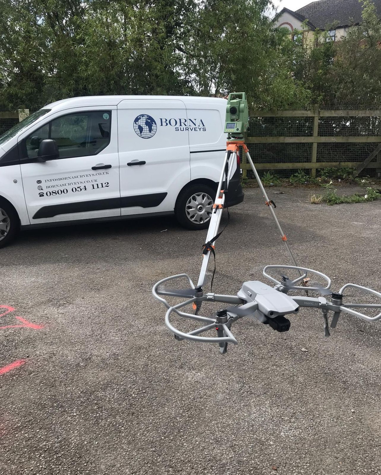
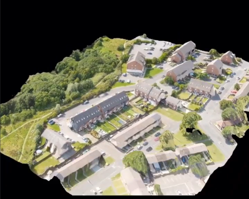

An aerial mapping allows the capture of Imagery & 3D Data. From video roof reports to combining 3D Drone Survey data with 3D Laser Scanner data, Borna Surveys carries out a variety of work involving the use of Drones.
The benefits of a drone survey include:
Efficiency:
Rapid data collection over large areas.
Accuracy:
High-resolution imagery for precise measurements.
Safety:
Avoids risks associated with manual surveys in challenging terrain.
Cost-effectiveness:
Reduces time and resource requirements.
Versatility:
Applicable to various industries like agriculture, construction, and environmental monitoring.
Real-time Data:
Enables quick decision-making with up-to-date information.
Accessibility:
Access hard-to-reach or hazardous locations without physical presence.
Environmental Impact:
Minimizes ecological disruption compared to traditional survey methods.
Detailed Visualization:
Provides 3D models and maps for comprehensive analysis.
Documentation:
Creates a comprehensive record for future reference and analysis.
A Drone Survey allows the capture of Imagery & 3D Data. From video roof reports to combining 3D Drone Survey data with 3D Laser Scanner data, Borna Surveys carries out a variety of work involving the use of Drones.
A Drone Survey can also be used in combination with traditional land surveying techniques. Our surveyors will pick up all survey detail with total stations & GPS keeping a very high surveying accuracy, and then can capture larger areas of spot levels with the drone survey. This allows a highly accurate survey but reduces time considerably on larger sites.
FAQ
A Drone Survey involves using unmanned aerial vehicles equipped with advanced sensors to capture high-resolution images and data of a site. Borna Surveys utilises drone technology to provide cost-effective, efficient, and accurate surveys, offering a comprehensive overview of your project site.
Drone Surveys offer several advantages over traditional methods, including rapid data collection, accessibility to hard-to-reach areas, and the ability to generate detailed 3D models. Borna Surveys leverages drone technology to enhance efficiency, accuracy, and data visualization for a wide range of projects.
Drone Surveys are versatile and applicable to various industries such as construction, agriculture, mining, and environmental monitoring. Borna Surveys tailors its drone services to meet the specific needs of clients in these sectors, providing valuable insights for planning, monitoring, and decision-making.
Absolutely. Drone technology excels in capturing data for projects of all sizes. Borna Surveys utilises state-of-the-art drones with advanced sensors to efficiently cover large areas, providing clients with detailed and timely information crucial for effective project management.
Borna Surveys delivers a range of actionable outputs, including high-resolution imagery, 3D models, topographic maps, and volumetric analysis. These deliverables empower clients with comprehensive data for decision-making, project planning, and monitoring, showcasing the versatility and value of our Drone Survey services.
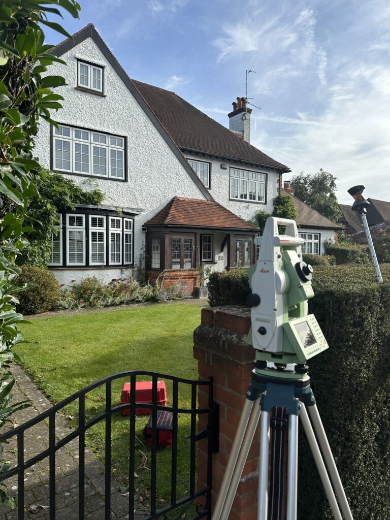
Why Choose Borna Surveys? We Guarantee
Accuracy and Precision:
We prioritise accuracy in every aspect of our work, ensuring that our clients receive reliable survey data for informed decision-making.
Timely Delivery:
Our efficient processes and advanced technology enable us to deliver survey results promptly, meeting your project timelines and deadlines.
Customised Solutions:
Recognising that each project is unique, we tailor our services to meet your specific requirements, providing personalised solutions that add value to your endeavors.
Experienced Professionals:
Our team of seasoned surveyors brings years of industry experience to the table, guaranteeing a high level of expertise in every project we undertake.
Client-Centric Approach:
We prioritize clear communication and collaboration, working closely with our clients to understand their needs and deliver results that exceed expectations.
Our Services
















Get in Touch
phone
+44 800 054 1112
Business Hours
- Every day 9am – 8pm